Saturday, November 10, 2012

Activists record 8N protest with drones, continue to take lead on drone coverage


Progress in covering large events with aerial drones, especially protests, has been led almost exclusively by political activists. The most recent effort by activists to use drones document the scale of anti-government demonstrations comes from Argentina, where the “8N” demonstration on Thursday, November 8.

That day, some 30,000 Argentinians protested economic conditions, government corruption and the fear that President Cristina Fernandez will attempt to end her term limit.

According to the group El Cipayo Argentino, the government had closed down the airspace ahead of the protest, and did not allow news helicopters to cover the event. So the group came up with a low-budget workaround: they built their own aerial drone to provide coverage from the sky.

As you can hear from the video, the camera attached to the drone picked up a great deal of propeller and motor noise. The fact that protestors can be heard above the din of the whirring motors speaks volumes.

Al Jazeera has a write up about the protest and the activists behind the drone here.

Friday, November 9, 2012

We need more drones because we’re having more big disasters.


The images of an inundated New York City certainly were eye-catching. But it isn’t until you start parsing the data that you start to really understand how bad things got for the East Coast.

Some of the most startling stats: winds pegged at 90 miles an hour when Sandy made landfall as a tropical storm. It left 185 dead between Jamaica and its terminus in the US. It was the second costliest hurricane in recorded history after Katrina, with $52.4 billion in damages. Five thousand commercial airline flights cancelled. Across 26 states, up to 80 million were affected. Eight and a half million people without power after the storm.

Even 11 days after the storm, with freezing winter temperatures closing in, 428,000 in New York and New Jersey remain without power.

Aon Benfield, an insurance broker that specializes in catastrophe management, crunched the numbers and found something just as remarkable about hurricane/tropical storm Sandy. Well, perhaps not so much about the storm itself, but how it fits into recent weather events and climate change in general.

“Devastating Hurricane Sandy was the eleventh billion-dollar weather-related disaster in the U.S. so far this year, and the most expensive,” wrote Wunderground.com’s Jeff Masters, of Aon Benfield’s latest report. “This puts 2012 in second place for most U.S. billion-dollar weather disasters behind 2011, when NOAA's National Climatic Data Center (NCDC) counted fourteen such disasters.”

Meanwhile, climate scientists noted that not only did global warming make such a historic slew of storms possible, it also made the sea level rise, thus increasing the damage to coastal areas.

“Sandy threw the ocean at the land, and because of global warming, there were about eight inches more ocean to throw,” wrote Chris Mooney on The Climate Desk. “As the water level increases, the level of damage tends to rise much more steeply than the mere level of water itself.”

When Thailand was flooded in 2011, the government contracted a drone to scout out where flooding had occurred, which helped make decisions about where and when to release flood gates. The contractor flew more than 60 flights over a period of 45 days, and claimed that the data obtained from those flights helped prevent the city of Bangkok from suffering more during that catastrophe.

That same year, back in the states, freelance journalist and storm chaser Aaron Brodie took sweeping shots of the Jersey Shore with his own multicopter before and after Hurricane Irene. He uploaded this footage on YouTube, but amended his post after Sandy:

“Irene was child's play in comparison to Superstorm Sandy. In fact, there was no real damage from Irene,” Brodie wrote.

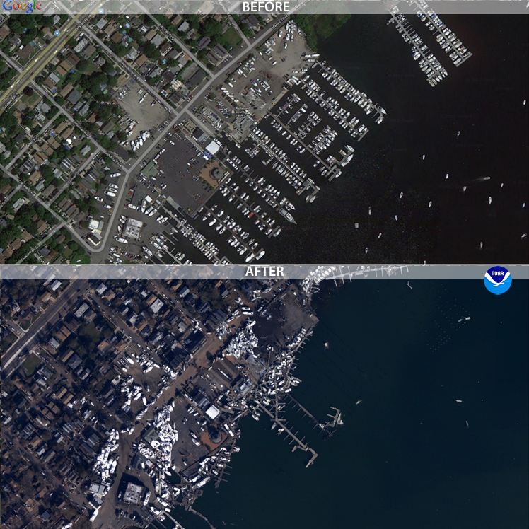
The public wasn’t able to obtain coverage from drones for Sandy. Some news sites did, however, post before and after photos of New York and New Jersey. These post-sandy aerial photos were obtained by the National Geodetic Survey, with the help of NOAA’s King Air and Twin Otter remote-sensing aircraft. The photos were set side-by-side with historic satellite imagery, allowing users to drag these images to do their own comparisons.


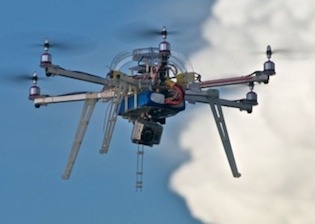
Because of the prohibitive cost of aerial photomapping, these images were gathered by government agencies. But, if FAA regulations allowed it, the job could have easily been done with a $1,000 aerial drone. That puts it within reach of even independent and backpack journalists. Or concerned members of the community.

If the climate models hold true, there’s going to be more “superstorms” like Sandy every year. There will be more billion-dollar disasters, more lives lost, more power outages, and the public will need more information about how those disasters are affecting their communities.

Drones are especially capable of giving quick data on the scope, or extent, of large-scale disasters. Now is the time for journalists to learn and perfect tools like the drone to give the public that information.

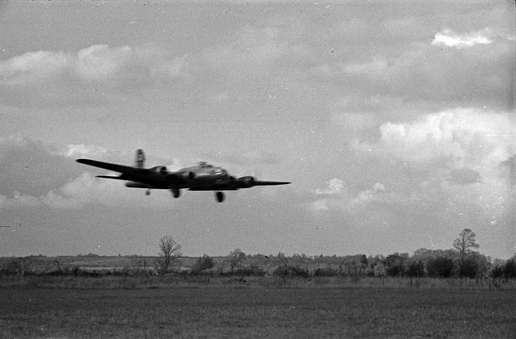
Photo at the top of the post is of post-Sandy flooding in Haiti, via the Flikr photostream of United Nations Stabilization Mission In Haiti.

Thursday, October 11, 2012

The case of Chicken v Bomber, and how it might impact drone law


The first thing you should know is if you run afoul (pun very much intended) of the law, I can’t bail you out. If you read the “About the Author” page on MentalMunition.com, you’ll note that I’m not a lawyer. My only legal qualifications are an undergraduate course in media law.

Having said that, I started researching drone law and writing back in March, shortly before the Brookings Institution organized a panel on domestic drones and privacy. The ACLU had just published a report in December 2011 called “Protecting Privacy from Aerial Surveillance: Recommendations for Government Use of Drone Aircraft” that referenced important Supreme Court cases that might play a role in drone law.

Just this week, Alexis Madrigal, the senior editor for the Technology channel at the Atlantic, wrote about two cases that could have some bearing on drone law, Guille v. Swan, and U.S. v. Causby. The latter involved dead chickens.

I’ll be writing about that case here. When we talk about drone laws, we’re talking about a speculative thing. To date, no journalist has been sued for violating rights of privacy with an unmanned aerial system. There is no legal precedent specifically for drones as of yet, although that might change in the near future. As drone technology proliferates, so too does the potential for abuse and for court cases.

But the United States courts are not absent of precedent that would come up in a privacy case involving drones. It’s is important to keep in mind that in many cases drone journalism is a form of aerial photography, albeit an unmanned form of aerial photography. Additionally, cases that consider whether the National Airspace System (NAS) is public or private are highly relevant.

Wednesday, October 3, 2012

Journalism Drone Development: aerial photo mosiacs, and what's the spatial resolution on this drone, anyway?


Above is an aerial mosaic -- a series of 11 photos taken from a small unmanned aerial vehicle (colloquially known as a drone) that have been stitched together in a mosaiking program.

That program, Microsoft Image Composite Editor, is normally used to stitch together a series of sweeping photos taken from the ground to make a single panoramic image. However, the algorithm used to find and match the edges of a series of sweeping photos of, say, the Grand Canyon, is the same algorithm needed to fit photos together to make a map or similar map-esque image from aerial photos.

So, what kind of drone journalism could you do with this kind of image? Aerial photographers have been able to capture a breathtaking, panoramic view of Moscow protests from drones. These drones offer a perspective that is especially helpful at documenting the scope or extent of protests, political rallies, construction projects, landmarks, geographic features, and natural and man-made disasters.

But what kind of data journalism can you do with these drones? That's to say, what kind of hard data can you obtain from these images to launch investigations? How about proving the existence of or extent of something, such as oil spills, wild fires, droughts, or lax construction codes following a disaster, with actual metrics?

Monday, September 10, 2012

Muck Rack hosts Drone Journalism Q&A

What are the rules on drone use right now? What would you use one for in journalism? What about ethics? Last week, the Muck Rack invited Nebraska Drone Journalism Lab's Matt Waite and DroneJournalism.org's Matthew Schroyer to a Twitter Q&A on drones to help answer those questions and more.

Read more on Muck Rack's site, which documented the fourteenth installment of their #muckedup chat.

Reposted from DroneJournalism.org

Wednesday, August 29, 2012

Drone Development In Progress: Aerial Photos and Videos


Despite JournoDrone 2 still being in the shop after its maiden flight, drone development is continuing onward and upward. Above is an aerial photo taken from my latest drone project, which has caused that previous drone to collect dust in the basement.

However, this new drone is superior in at least a couple of ways. One, it's much more stable in flight, thanks to its 68.5" wingspan. Its size also means it can loft a larger payload. The photo above was taken using an 11Mpx GoPro Hero 2, which is small, but has a not insignifcant weight penalty.

JournoDrone 2 was a plastic shell that I wrapped in carbon-fiber and epoxy, which could take a crash on the nose without much harm. This newest drone is made of balsa wood, but it's such a docile aircraft that the need for crash resistance is minimal. All that balsa, some 5 or so pounds of it, is also pretty good at flexing and absorbing a hard landing.


Tuesday, August 28, 2012

Drone Journalism at SXSW, now on the PanelPicker

We almost didn't make it on the list, but at the last minute, several of the DroneJournalism.org developers and myself were able to get on the PanelPicker for SXSW Interactive.

We want to show one of the most important tech conferences in the country what Drone Journalism is all about, with a panel we call "Drones for Journalists: Reporting Evolved." We'll be taking the audience through the basics: what is a drone, how can journalists use them to cover live events and augment investigative journalism, and what's been done to this point. We'll also answer questions about ethics, regulation, and the DIY tech behind this emerging field of journalism.

Here's the description we put on the PanelPicker:

Civilian and commercial drones are coming. As many as 30,000 drones, or unmanned aerial systems (UAS), will be flying in the national airspace within 8 years, by FAA estimates. For the first time, the kind of intelligence once reserved for governments is opening to journalists and the media. This panel brings together an expert in disaster reporting, a data-minded journalist who is developing drones to conduct investigations, and a former war reporter and Discovery Channel documentarian who uses a drone to record landscapes and events from a new perspective, to discuss how this technology is being used today, and how it may be applied in the future
At the speed drone development is coming along, March seems pretty distant in the future. But we've got some pretty interesting things to show, and we anticipate even more impressive things (i.e. some brand new drone-assisted reporting that we have in the works) will happen by presentation time.

We just have one problem. Many of these panels and presentations vying for a spot in this prestigious event had at least a couple more weeks than we had to generate votes (these votes count 30% to the ultimate decision). We are trying to get as many votes as possible to narrow the gap, so we can make it to SXSW and show the public what these drones are all about.

Hopefully we will see you in Austin this March.