Sunday, March 13, 2016
Working with PhotoScan in the cloud
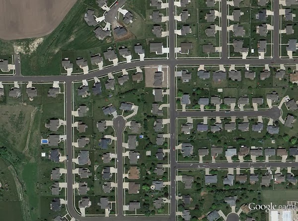
Back in 2012 when I first started flying drones to make high-resolution photomaps (e.g., strapping a first-generation GoPro to the bottom of a balsa-wood DIY drone and hoping for the best), there were few options for processing the photos.
Basically, if you didn't have access to $2,000 software, you only had Microsoft Image Composite Editor (ICE) to stitch together the photos into mosaics. Fortunately, much has changed since then.
In a window of just two years, a number of software solutions became available. VisualFSM brought free, open-source photogrammetry to tech-savvy hobbyists and researchers. There was Autodesk's 123D catch, which could be used with drone imagery in a pinch. Pix4D came about in 2011, which later gained a huge market share in the professional UAS space. I won't get into all the options, but there's a fairly comprehensive table on Wikipedia that you might wish to look at.
The solution I use most often today is Agisoft PhotoScan. The feature set of the standard version is somewhat limited compared to solutions designed specifically for UAS use, but it's also easy to use, the software license is comparatively cheap, and it runs on ordinary desktop machines.
Many photogrammetry services are run in the cloud (123D catch, Pix4D, DroneMapper), which has its benefits. You don't have to upgrade your machine to run complex models. You don't have to tie up a computer for hours while it's processing 500-1,000 photos. You can start a job in another country, send your images to the cloud instance, and by the time you arrive back home, your job can be done.
But processing in the cloud can mean paying fees by the month or by the job. If you like paying a one-time fee for a license, the cloud may not be the most attractive solution.
Thankfully, PhotoScan can be run in the cloud. While it does mean incurring hourly fees for computer time and cloud storage, it can also help in a pinch when you're working on an especially large project.
Tags:
3D modeling
,
Amazon
,
AWS
,
drones
,
EC2
,
photogrammetry
,
PhotoScan
Saturday, February 27, 2016
Scraping crowd-sourced shake reports to produce a cumulative shake map for Oklahoma earthquakes
Last year, Oklahoma had more earthquakes than ever
before. In 2015, the Oklahoma Geological Survey (OGS) counted 5,691 earthquakes[1] centered in the state. That’s
270 more quakes than what Oklahoma experienced in 2014.
Along with more reports of earthquakes, came more
reports of earthquake damage[2]. In one of the worst
earthquake swarms in 2015, a chimney was torn from a house in Edmond[3], and an exterior wall of
bricks came tumbling down from an apartment complex in northeast Oklahoma City[4]. Much has been learned since
Oklahoma's earthquake surge began in 2009.
Scientists now link these earthquakes to the injection of waste water into deep disposal wells[5]. Water exists naturally in the earth along with oil and gas deposits, and when the oil and gas is drawn from the earth, the water comes with it. This water is separated from the oil and gas, and is disposed of in deep wells. Because these quakes are caused by human activities, they are known as “induced earthquakes.”[6]
Many questions remain, however. Namely, what are the
long-term effects of having so many small earthquakes so frequently? And how is
it possible to compare the impact of these quakes across Oklahoma? The United
States Geological Survey produces damage estimates automatically after
significant earthquakes, but it does not produce damage estimates for swarms of
smaller earthquakes, which may last for months or years.
Tags:
big data
,
CartoDB
,
cost
,
cumulative shaking
,
damage
,
data
,
data science
,
datavis
,
earthquake
,
fracking
,
impact
,
induced earthquakes
,
intensity
,
magnitude
,
mapping
,
Oklahoma
,
Python
,
R
,
visualization
Thursday, November 5, 2015
Climbing a virtual mountain, Cesium, and other big life moments
Much has happened since my last update, but I'll keep it simple. Last August, my lovely wife finished her awesome dissertation on the roots and development of toxic discourse in science fiction. With her PhD and job offer in hand, we left the University of Illinois for Oklahoma City (Urbana we will always love you).
Initially, I kept working remotely for the National Science Foundation grant, EnLiST, continuing the analysis of our teaching and learning network data and helping UIUC faculty plan for future grants. Eventually I did hit the job market, and became the instructional technologist for the Center for Learning and Teaching at Oklahoma City Community College.
What does that mean? Basically, it means making sure the college stays up-to-date with technological change. Some days this means helping faculty with changes in our learning management system (LMS). Other days, it means building 3D models, visualizations, and applications for learning (such as this digital mountain).
Tags:
Cesium
,
CesiumJS
,
css
,
Elk Mountain
,
GIS
,
javascript
,
mapping
,
nature
,
Oklahoma
Tuesday, December 16, 2014
Here's a holiday gift guide to help you get started in drones
While drones have some great potential both as a tool and an educational hobby, it can be rather intimidating to get started.
There's just so many platforms and widgets to choose from, and it seems every day someone is launching a new type of drone. As I pointed out in a recent post on the sensor journalism Google group, I actually think the market might be bottoming out for creating drone hardware, so hopefully the selection process will be easier in the future.
Complicating the matter is that drones can crash or fly off if they lose a GPS lock, risks that are substantially higher when you're just starting off. Having a $1,000 drone fly off with a $300 camera is not a fun or rewarding introduction to drones and remotely piloted aircraft systems.
So, I've made a holiday gift guide for Make Magazine to show people options for the beginner, intermediate, and advanced drone operator.
If you've never flown a remote controlled aircraft before, I highly recommend something like the Walkera Ladybird. Myself, I've had a fair bit of luck with Quanum Nova, which has an attractive feature set and price for intermediate operators who don't need to loft heavy cameras or go beyond visual line of sight.
Whatever drone you end up choosing for yourself or a special someone, remember to drone responsibly. That means, among other things, picking up an AMA membership and the complimentary insurance that comes with it.
Tags:
diy drones
,
drones
,
getting started
,
MAKE
,
Make Magazine
,
makerspace
,
RPAS
Thursday, February 27, 2014
A call for journalists and makers to join hands around IOT and evidence-based journalism
Writing for Al Jazeera English, D. Parvaz reported on a recent conference for atomic experts organized by the International Atomic Energy Association (IAEA), where it was remarkably difficult to get answers from atomic experts.
The conference, titled “International Experts’ Meeting on Radiation Protection after the Fukushima Daiichi Accident – Promoting confidence and understanding,” was generally closed to the media. Journalists received presentations on USB drives, but were not given any opportunities for Q&A. The media handlers were pleasant, but not very helpful, Parvaz noted.
Great! I requested an interview with the IAEA Scientific Secretariat, Tony Colgan (no can do). Or a statement on why the conference was closed to the media (not so much). How about an IAEA expert on the effects of radiation on sea life? (Nope).
For a conference designed to “promote confidence and understanding” with the public, there was very little engagement with the public. Despite this, Parvaz did find one group of presenters who were very helpful and answered her questions.
Monday, February 24, 2014
Satellite images show devastating effects of a big tornado on a small Illinois town


The Nov. 17, 2013 tornado outbreak ended the lives of three people in the town of Washington, Ill., and upended the lives of many in the town of 15,000.
Many news stations released aerial photos of the devastation, but only recently were satellite photos released which gave a new appreciation of the scope of the disaster. As many as 500 homes were damage or destroyed during the tornado outbreak.
Tags:
data
,
data journalism
,
drone
,
drone journalism
,
Gifford
,
GIS
,
jQuery
,
satellite photos
,
tornadoes
,
Washington
Tuesday, February 4, 2014
A bug's eye view, brought to you by a nano quadrotor drone.
What's better than a tiny drone that buzzes like a bee through offices and hallways? How about a tiny drone shielded with a 3D-printed frame, controlled by a Raspberry Pi base station, and equipped with a miniscule video camera and transmitter?
Tags:
3d printing
,
aerial drones
,
Bitcraze
,
Crazyflie
,
drone journalism
,
drones
,
drones for good
,
FPV
,
maker
,
nano copter
,
nano drone
,
nano transmitter
,
rapid prototyping
,
STEM education
,
unmanned aircraft systems
Monday, January 13, 2014
A discussion on deploying drones for international development
Last month, Deutsche Post DHL transported six kilograms of medicine from a pharmacy in Bonn, across the Rhine River, to its headquarters.
This wouldn't have made international news, except that DHL accomplished this with an unmanned aircraft system - commonly known as a drone.
This came less than a week after Amazon's Jeff Bezos claimed his company would deliver products to customers' doorsteps via drone in three or four years. Regulations and technological hurdles would make Bezos' plan all but impossible in the US near-term, but DHL proved that with proper planning and logistics, you could deliver small parcels with small drones today.
On January 22, The International Research and Exchange Board, or IREX, will be hosting a "deep dive" discussion on how this same technology could benefit international development.
Tags:
deep dive
,
drone journalism
,
drones
,
drones for development
,
drones for good
,
IREX
,
RPAS
,
sUAS
,
UAS
,
UAV
Tuesday, December 24, 2013
Missed target, found hooliganism on drone mapping mission
| A small unmanned aircraft system for mapping, developed for a National Science Foundation grant to improve STEM education. |
In north Louisiana, there’s a fantastic little place known for Muscadine grapes, pecans, and on occasion, alligators.
Muscadines always get turned into jelly; an excellent topping for southern-style biscuits (my wife says she’s still working on mastering the family biscuit recipe, but she’s produced the finest biscuits I’ve ever had the pleasure of eating).
Pecans, a grocery bag of which could fetch a gold bar by northern exchange rates, are so plentiful that they must be given away. They’re so much a part of my wife’s heritage that we decided to get married beneath those pecan trees.
And when the water is high in the backyard bayou, a small alligator sometimes will make itself at home. If the alligator is lovingly cared for and becomes fat, a portion of that alligator eventually will make its way to our dinner table in the form of a delightful alligator sauce piquant (wife insists that it be cooked like shrimp, and not burnt to a crisp as it’s done here in the North).
So before we went down to visit my wife’s family farm for Thanksgiving, I decided to pack up one of the “drones” I’ve developed at the National Science Foundation grant where I work, to see if I couldn’t map out this interesting place.
Tags:
bayou
,
drone
,
drone mapping
,
hooliganism
,
Louisiana
,
mapping
,
photomapping
,
shenanigans
,
small UAS
,
stall speed
,
tomfoolery
,
unmanned aircraft system
Monday, November 25, 2013
There's been a big uptick in drone research over the last decade
Recently, I was tasked with producing some basic citations on unmanned aerial vehicles, more commonly called drones, for a new grant proposal. As you could imagine, it was not hard to find a cornucopia of papers reflecting the many novel uses for the technology.
What might surprise some, though, was the sheer increase in drone research, how popular these papers are in the academic world, what that research trying to accomplish, and who was funding it.
Tags:
drone research
,
drones
,
research
,
UAS
,
UAV
,
UAV research
,
unmanned aerial vehicles
,
unmanned aircraft systems
Monday, October 28, 2013
Building and flying an incredibly tiny quadrotor drone
At the National Science Foundation grant where I work, EnLiST, we've been tinkering with various different drone platforms which could be easily deployed in classrooms for valuable STEM (Science Technology Engineering and Mathematics) lessons.
Although we're focused on STEM education, it's not hard to see how some of these drones can be used in a variety of other fields. The quadrotors we develop one day could be deployed for research in environmental science, geology, city planning, and even "evidence-based" journalism.
Drones are useful like that. At the end of they day, they're simply a means of getting a sensor from one place to another. What you use that sensor for, is entirely up to the teacher, scientist, or journalist.
We needed a drone that was small enough to fly in a classroom, easy enough for children to fly (not saying much as kids tend to pilot drones with relative ease), and hackable enough that we could mold it to fit our science curriculum.
Giving the CrazyFlie nano quadrotor a spin in the EnLiST grant office. We call it "bumble." https://t.co/ySDnm26wAi
— Matthew Schroyer (@matthew_ryan) October 14, 2013
Enter the Crazyflie nano, a tiny, open-source drone developed by Swedish hackers at Bitcraze.se. At 19 grams, and measuring 9 cm from motor to motor, it's one of the smallest quadrotor drones on the market today.
Tags:
aerial drones
,
Bitcraze
,
Crazyflie
,
data journalism
,
drone journalism
,
multicopter
,
nano copter
,
nano drone
,
quadrotor
,
sUAS
,
x8
Friday, October 18, 2013
Measure air pollution in your home or backyard with a DustDuino
This week, the World Health Organization (WHO) took a major step by announcing that air pollution is carcinogenic to humans.
WHO also announced they are considering particulate matter, a major component of indoor and outdoor air pollution, as carcinogenic to humans as well.
International Agency for Research on Cancer announced today: outdoor #airpollution is leading environmental cause of #cancer deaths
— WHO (@WHO) October 17, 2013
The International Agency for Research on Cancer (IARC), a special unit inside WHO tasked with promoting international collaborations on cancer research, reached that conclusion after reviewing more than 1000 scientific papers on the carcinogenicity of air pollutants.
Air pollution and particulate matter will be included in IARC's Monograph, which is an encyclopedia of known carcinogens. Particulate matter will be classified as a Group 1 carcinogen, along with tobacco smoke and asbestos.
In an IARC press release [1], the Deputy Head of the Monographs Programme, Dr. Dana Loomis, said that the group's goal was to "evaluate the air everyone breathes rather than focus on specific air pollutants."
"The results from the reviewed studies point in the same direction: the risk of developing lung cancer is significantly increased in people exposed to air pollution," he said.
This finding elevates the urgency to clean up the air, both outdoors and indoors. But how does one find out the condition of the air in the first place? How healthy is your air?
Monday, September 23, 2013
Drones, journalism, and the peak of inflated expectations
It's a story that's been repeated time and time again with emergent technology. Researchers publish some new breakthrough, and the press grabs hold of the news release and begins extrapolating stories about how the new tech could revolutionize our lives. Expectations build as ideas bounce within the media echo chamber, pitchmen evangelize audiences at the trendy tech conferences, and venture capitalists make power plays in the market.
Everyone wants a piece because the sky is the limit, and the sky is the limit because everyone wants a piece.
Products finally hit the market, and eventually, reality sets in. Like the doomsayers who predict apocalypse time and time again, the prophesied miracles fail to materialize. The technology is immature. Deliverables fail to match objectives. Most importantly, the technology was overvalued, and an adjustment takes place.
This "hype curve" -- rising expectations, peak interest, and curbed enthusiasm -- doesn't happen to every piece of technology that comes around. But this bubble does happen with surprising regularity. Every year, Gartner, a tech research corporation, produces a report that attempts to identify where various technologies are riding on this bubble.
Gartner released its latest report, "2013 Hype Cycle for Emerging Technologies," last month. In it, the company prognosticates that drones and other unmanned technologies are coming up to that peak. At that point, the unmanned systems sector might be in for some pain.
Tags:
data journalism
,
drone boom
,
drone hype
,
drone journalism
,
drones
,
Gartner
,
hype curve
,
precision agriculture
Thursday, September 5, 2013
Understanding air pollution with a simple dust sensor
Outdoor air pollution, in the most extreme cases, can be immediately identified even without any special training. It casts a haze over cities, collects on streets and buildings, and provides dramatic fodder for the news. Even when the air pollution isn't actually visible, we can smell when something isn't quite right.
I previously wrote about how difficult it can be to obtain basic environmental data, and how government budget cuts are threatening air monitoring networks in several states. It now appears that other countries are making hard decisions about which monitors to keep, and which monitors to shut down. The Guardian reported recently that up to 600 air quality monitors, including monitors for nitrogen dioxide and particulate matter (PM), could be shut down across the United Kingdom.
Yet for all the attention the media pays to outdoor pollution, people spend only about 1 to 2 hours outdoors (and that's only in the pleasant summer months) according to one University of Newcastle study. According to the EPA, we spend about 90 percent of our time indoors. We spend the vast majority of our time indoors, so it makes sense monitor pollution in the home.
Indoor Air Pollution (IAP) is an especially big problem in developing countries, where 60 to 90 percent of households still rely on coal and wood for heat and food preparation. About 36 percent of acute lower respiratory infections and about 22 percent of chronic obstructive pulmonary disease (COPD) in the developing world are caused by IAP (pdf). In one study of women in China, researchers found that a 10 μg/m3 (microgram per cubic meter) increase in PM1 (ultrafine particles smaller than one micrometer) was associated with 45 percent increased risk of lung cancer.
IAP isn't just a concern in developing and BRIC nations, though. Similar problems exist for the rural poor in the US and Canada, where indoor pollution exceeds the World Health Organization air quality guidelines in up to 80% of homes. As in BRIC nations, these homes rely greatly on burning organic fuels.
Air quality at home can be an issue even for homes that don't burn wood or coal. Indoor air pollution can come from "molds, bacteria, viruses, pollen, animal dander and particles from dust mites and cockroaches," according to the American Lung Association.
Indoor air pollution ranks among the top five environmental risks to public health, the EPA says. Indoor pollution levels may be two to five, and sometimes 100, times higher than outdoor pollution.
All that makes the indoors a great place to put a dust sensor.
Tags:
air monitoring
,
air quality
,
community sensing
,
crowdsourcing
,
dustduino
,
environmental journalism
,
EPA
,
IEPA
,
indoor air pollution
,
NAAQS
,
sensor journalism
,
Sharp GP2Y1010
Tuesday, August 20, 2013
IEPA is silent on request for data, emails surrounding large tire fire
When a supply of one million tires caught fire in Hoopeston, IL, there were no environmental monitors to track pollution in the community.
IEPA responded to the event along with firefighters, and has been keeping tabs on pollution ever since. With the fire extinguished, IEPA's primary concern has been shifted to the tire dust kicked up during cleanup.
From university research, we know an uncontrolled tire burn releases cancer-causing chemicals and mutagens (pdf). But it's been 61 days since the fire began, and the public is still in the dark on pollution figures from this massive fire.
Friday, August 16, 2013
Even with a ton of drone regulations, there was a ton of innovation at the SUSB Expo
![]() |
| An MLB Company representative shows the company's Super BAT's camera gimbal system to an audience member during the SUSB Expo, in San Francisco, CA. |
It's not very often you get the chance to watch the birth of a multi-billion dollar industry firsthand. But if we are to believe the Association for Unmanned Vehicles and Systems International (AUVSI) economic report, which estimates the unmanned aviation industry should reach $82 billion by 2025, that's exactly what happened at the first-ever small business expo for unmanned aircraft, the SUSB Expo, in San Francisco.
"It's like being in Steve Job's garage," said Agriflight's Bruce Parks, as reported by Robohub's Andra Keay.
Tags:
3DRobotics
,
Chris Anderson
,
drones
,
drones for good
,
San Francisco
,
SUSB Expo
,
sUSBExpo
,
unmanned aircraft
,
unmanned aircraft systems
Wednesday, July 31, 2013
Hot spots linger during Hoopeston tire fire cleanup, FOIA filed
![]() |
| Firefighters attempt to extinguish the tire fire at J&R Used Tire Service in Hoopeston, Ill., on June 19. Photo by Dan Johnson. |
According to the Champaign News-Gazette, officials from the Illinois Environmental Protection Agency (IEPA) say the site has dried out since firefighters poured hundreds of thousands of gallons of water on the tire fire at J&R Used Tire Service in Hoopeston, Ill. on June 19. This is creating an issue for "tire dust," which can not be kept down with more water.
Tags:
air monitoring
,
air quality
,
environmental journalism
,
Hoopeston
,
Hoopeston tire fire
,
IEPA
,
J&R Used Tire Service
,
mutagens
,
soil quality
,
tire fire
,
toxic
,
water quality
Wednesday, July 24, 2013
Michigan also faces cutbacks in air quality monitoring, risks violating federal requirments
Illinois isn't the only state facing cutbacks in environmental monitoring due to state and federal budgets. In its annual plan to monitor air quality, Michigan also revealed it is having difficulties keeping its network of air monitors intact.
Unlike Illinois, however, Michigan's cutbacks threaten the state's ability to meet federal laws for air monitoring.
"The MDEQ (Michigan Department of Environmental Quality) cannot implement all of the new monitoring requirements described above without new funding and a concomitant reduction in other monitoring requirements due to financial and staffing limitations," the state's environmental agency wrote in its 2014 ambient air monitoring network review (PDF).
Monday, July 22, 2013
UAVs Pros Cons in Toronto: safety and dialogue are keys to legitimacy
![]() |
| Ian Hannah of Avrobotics.ca displayed his professional hexcopter at the UAVs Pros Cons Symposium in Toronto. |
The townspeople may or may not be "real" about their proposed law, given the likelihood of people being injured by gunfire or falling drones, but fear of unmanned aircraft systems (dronephobia?) is real. This fear is rooted in a disconnect between popular media, and the actual uses and potential for the technology.
UAVs Pros-Cons was an effort bring expert knowledge to the public, while at the same time providing a discussion of many of the legitimate concerns over drones and their uses.
Tags:
Alexander Hayes
,
Andrew Clement
,
Avner Levin
,
Avrobotics.ca
,
drones
,
Ian Hannah
,
Katina Michael
,
pros cons
,
Ramona Pringle
,
Ryerson
,
sUAS
,
Toronto
,
UAS
,
UAVs
,
UAVs Pros Cons
Wednesday, July 17, 2013
A massive, toxic tire fire, and how citizen sensor journalism could have informed a community in crisis.
![]() |
| A fire at a tire disposal plant in the small town of Hoopeston, Ill., polluted the skies for hours. Photo by @JonathonLinares. |
Initial reports from fire crews suggested the fire could burn for days. By the time it was extinguished the next day, more than 100 firefighters from two states had come to snuff the tire fire, about 500 homes had been evacuated, and rail service through the town was shut down.
According to the Champaign-Urbana NPR affiliate WILL, state environmental officials requested that the state's attorney general to issue a court order to stop the business until it's determined how the fire started, how safe the business is, and what kind of environmental impact this fire had on the community.
The Illinois Environmental Protection Agency seems primarily concerned with the air and water at the moment. A tremendous amount of water was used to extinguish the blaze, and that water has been contaminated with the byproducts of burning tires.
Obviously, there's a great deal of burning material that was sent into the air. IEPA has been monitoring the air in Hoopeston (pop. 5,321), but that data hasn't been made public on any sort of accessible website.
Subscribe to:
Comments
(
Atom
)


